
SARAL
In orbit NORAD 39086 CVJK-7644-2588-4230-2659 ISRO France India

Time in UTC
16:36
Next pass · МАН РС(Я) ГЕОСКАН УКВ · 11°
10.10 23:09
Scheduled · Омский аграрный университет им. П.А.Столыпина
92
Observations over 30 days
43%
Successful observations
28k
Frames, latest 2026-10-04 00:07 UTC
The satellite is in orbit
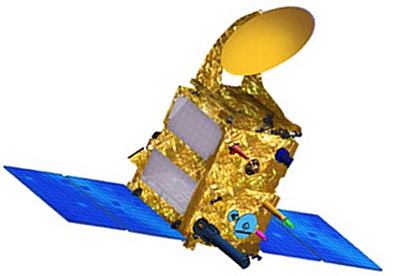
Gallery
1 39086U 13009A   26283.25827802  .00000056  00000-0  36643-4 0  9991
2 39086  98.5552 108.3924 0001246 346.0408  14.0742 14.32911502712081

Mean elements of every TLE set over the past 365 days, plotted against the epoch of the set. Each source is its own line; click it in the legend to hide it. A jump in altitude is a manoeuvre or a bad set; lines drifting apart are a disagreement between sources. “TLE age” is how many hours have passed since the epoch of the source's freshest set, plotted against when the set reached us, on a logarithmic scale. A set the source repeats unchanged does not reset the age.
Each TLE set is propagated with SGP4 to the epoch of the next set from the same source and compared with it, plotted against the epoch of the next set; the tooltip shows how many hours ahead the prediction ran. The logarithmic scale shows the size of the divergence and the tooltip its sign: plus along-track means the prediction is ahead of the satellite. This is how well the sets agree, not the true error: the reference is a TLE too, off by about a kilometre. An outlier is a manoeuvre between sets. Sets more than a week apart are not compared.
| Time of closest approach, UTC | Object 1 | Object 2 | Distance, km | Speed, km/s | Max. probability |
|---|---|---|---|---|---|
| 2026-10-10 17:34:01 |
SARAL
NORAD 39086 |
UNKNOWN
NORAD 82139 |
3.033 | 11.98 | 3.1e-07 |
| 2026-10-11 02:12:53 |
SARAL
NORAD 39086 |
COSMOS 1818
NORAD 17369 |
0.326 | 14.74 | 1.4e-03 |
| 2026-10-11 04:20:53 |
SARAL
NORAD 39086 |
CZ-6A DEB
NORAD 60658 |
4.884 | 14.33 | 7.9e-08 |
| 2026-10-11 06:04:41 |
SARAL
NORAD 39086 |
SAPPHIRE
NORAD 39088 |
2.439 | 1.08 | 7.4e-07 |
| 2026-10-11 09:39:27 |
SARAL
NORAD 39086 |
CZ-6A DEB
NORAD 54634 |
1.565 | 14.63 | 6.9e-07 |
| 2026-10-11 11:11:37 |
SARAL
NORAD 39086 |
COSMOS 1190
NORAD 11869 |
3.961 | 9.27 | 5.4e-07 |
| 2026-10-11 11:25:17 |
SARAL
NORAD 39086 |
CZ-6A DEB
NORAD 54468 |
4.991 | 14.75 | 6.5e-08 |
| 2026-10-11 12:26:10 |
SARAL
NORAD 39086 |
COSMOS 2251 DEB
NORAD 37089 |
4.856 | 14.85 | 6.4e-08 |
| 2026-10-11 18:43:48 |
SARAL
NORAD 39086 |
IRIDIUM 126
NORAD 42809 |
3.770 | 14.76 | 1.1e-07 |
| 2026-10-12 02:23:40 |
SARAL
NORAD 39086 |
SL-16 DEB
NORAD 29098 |
4.655 | 14.82 | 7.3e-08 |
| 2026-10-12 09:24:40 |
SARAL
NORAD 39086 |
CZ-6A DEB
NORAD 60679 |
2.798 | 14.86 | 1.9e-07 |
| 2026-10-12 22:22:02 |
SARAL
NORAD 39086 |
NOAA 16 DEB
NORAD 41413 |
1.650 | 12.76 | 9.6e-07 |
| 2026-10-13 01:23:34 |
SARAL
NORAD 39086 |
FENGYUN 1C DEB
NORAD 31721 |
4.773 | 14.76 | 7.4e-08 |
| 2026-10-13 05:54:33 |
SARAL
NORAD 39086 |
NOAA 16 DEB
NORAD 41413 |
4.979 | 12.73 | 1.1e-07 |
| 2026-10-13 17:34:41 |
SARAL
NORAD 39086 |
PEGASUS DEB
NORAD 39312 |
4.221 | 14.36 | 1.0e-07 |
| 2026-10-13 20:56:31 |
SARAL
NORAD 39086 |
IRIDIUM 107
NORAD 42960 |
3.973 | 13.82 | 1.4e-07 |
| 2026-10-14 07:58:13 |
SARAL
NORAD 39086 |
WEBERSAT (WO-18)
NORAD 20441 |
2.924 | 14.36 | 1.1e-07 |
| 2026-10-14 10:19:17 |
SARAL
NORAD 39086 |
IRIDIUM 148
NORAD 43255 |
2.500 | 13.40 | 3.7e-07 |
| 2026-10-14 14:42:06 |
SARAL
NORAD 39086 |
DMSP 5D-2 F13 DEB
NORAD 40447 |
2.830 | 14.51 | 2.2e-07 |
| 2026-10-14 18:39:12 |
SARAL
NORAD 39086 |
IRIDIUM 137
NORAD 43076 |
2.616 | 14.64 | 2.4e-07 |
| 2026-10-15 01:41:40 |
SARAL
NORAD 39086 |
DMSP 5D-2 F13 DEB
NORAD 40677 |
3.432 | 14.70 | 1.4e-07 |
| 2026-10-15 09:54:56 |
SARAL
NORAD 39086 |
IRIDIUM 167
NORAD 43931 |
2.135 | 14.83 | 3.3e-07 |
| 2026-10-15 12:17:48 |
SARAL
NORAD 39086 |
USA 81
NORAD 21949 |
0.571 | 12.19 | 8.6e-06 |
| 2026-10-15 12:19:52 |
SARAL
NORAD 39086 |
IRIDIUM 33 DEB
NORAD 46974 |
2.588 | 14.12 | 3.0e-07 |
| 2026-10-15 13:08:05 |
SARAL
NORAD 39086 |
USA 81
NORAD 21949 |
4.788 | 12.17 | 1.2e-07 |
| 2026-10-16 01:06:01 |
SARAL
NORAD 39086 |
FENGYUN 1C DEB
NORAD 35203 |
4.231 | 14.66 | 9.9e-08 |
| 2026-10-16 08:34:27 |
SARAL
NORAD 39086 |
FENGYUN 1C DEB
NORAD 31507 |
3.822 | 14.39 | 1.2e-07 |
Data: CelesTrak SOCRATES Plus, computed from TLEs of the public catalog. This is an estimate, not grounds for a manoeuvre: TLEs carry no covariance, and the maximum probability assumes a position error.